 odyvero
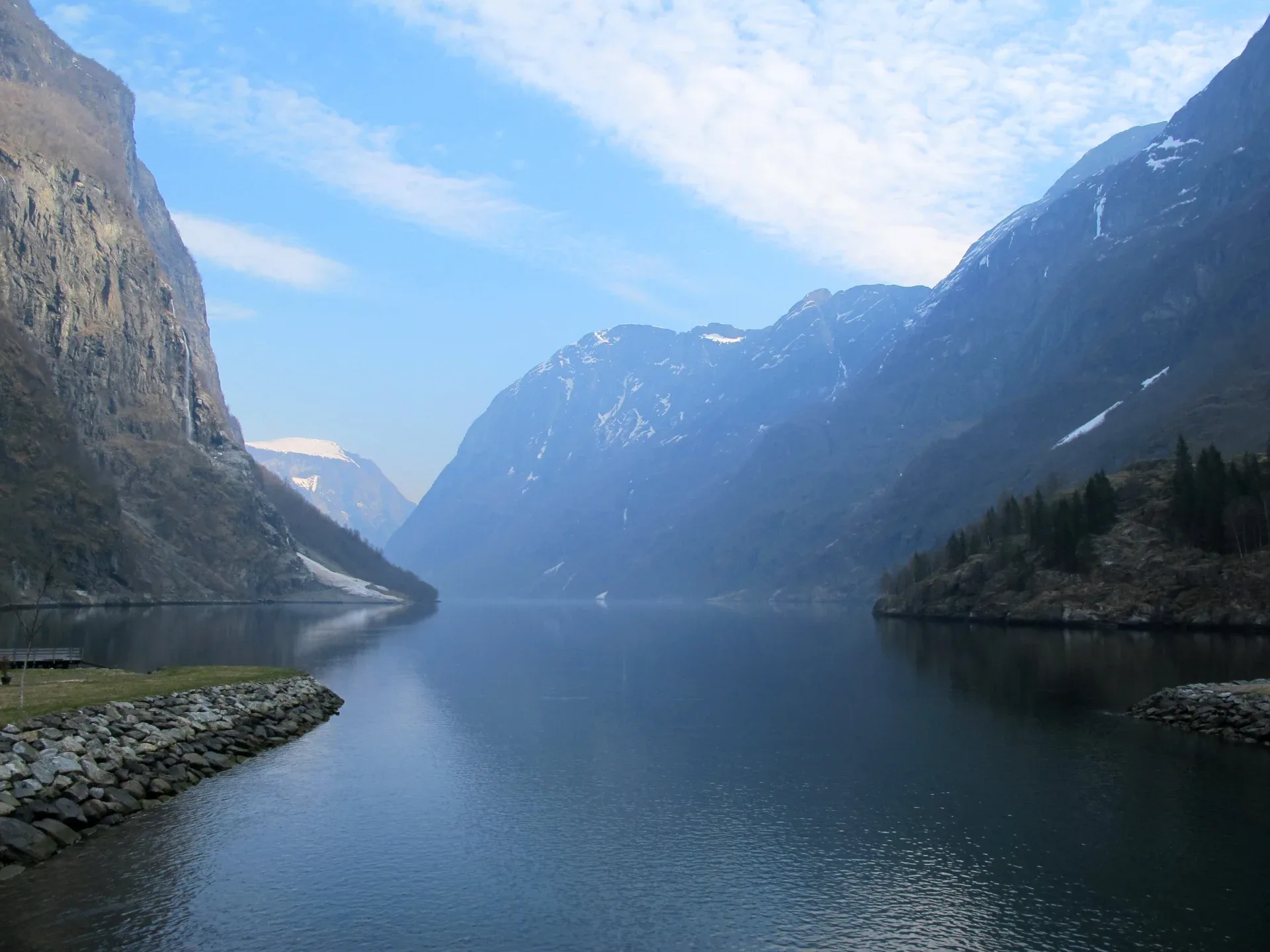
Between a Madeira levada, a Norwegian viewpoint and a traverse of the Dolomites, the level of commitment changes as much as the scenery. Here are twelve routes to help you choose your walking trip: six day hikes and six multi-day treks, with useful distances, the best seasons and the reservations that actually shape your stay.
Duration and terrain
At the foot of a Norwegian cliff, a hike can fit into a single vacation day. In the Dolomites, a succession of mountain huts can take up almost the entire trip. So the first decision is how much of your stay you want to devote to hiking. Would you rather return to the same accommodation each evening, or carry your pack to a new stage? Your answer determines transport, how much you carry and how flexible you can be with the weather.
For a first experience, a base camp lets you try different terrain without booking a whole chain of overnight stays. Madeira offers a walk alongside an irrigation channel; the Cinque Terre combine steps, vineyards and villages; Preikestolen packs a climb and a panorama into a few hours. Trolltunga is also a day hike, but requires considerably more stamina. Its length means you should treat it as the main objective of the day.
For a multi-day trek, check every stage, not just the total distance. The Tour du Mont-Blanc and Alta Via 1 involve substantial climbing; Laugavegur adds river crossings and Iceland’s highland conditions. On the West Highland Way and Juliana Trail, how you divide up the nights allows more variety in daily distances. The GR20 requires solid mountain experience.
The times below come from the trail operators where they are specified. They are hiking-time estimates; allow extra time for breaks, transport and your own buffer. A comfortable pace on a track can slow considerably on steps, boulder fields or wet sections. Compare your recent hikes with the terrain described before choosing a route.
Seasons for a walking trip
For a combination of high alpine mountains and long Nordic days, summer is the easiest planning window. Snow cover, mountain huts and transport services still matter, however. In Iceland, Ferðafélag Íslands places highland bus services between late June and early September, depending on the service. In the Alps, a date on the calendar does not prove that every pass is passable.
Spring and autumn can suit a trip focused on the Italian coast, Slovenian valleys or Madeira’s levadas, with each day adapted to local conditions. The exposed paths of the Cinque Terre require good weather; the wet forests of Rabaçal can be slippery. In the Picos de Europa, heat, precipitation and trail conditions affect your comfort more than a simple season label.
The contrast is particularly important in Norway. Preikestolen 365 lists June, July and August as peak season. Trolltunga recommends independent hiking in summer only for experienced hikers, from June 1 to September 30; a guide is recommended the rest of the year. Snow, ice and short days change the demands of the hike.
If you are planning for next summer after autumn 2026, use these windows to choose a region, then wait for information about the relevant season before finalizing overnight stays and transfers. The 2026 staffed season on the GR20 has already ended. This year’s dates do not confirm opening in 2027. A flexible transport ticket and a spare day may be more useful than a packed schedule with no breaks.
Preikestolen above the Lysefjord
The Preikestolen trail leads to a rocky platform overlooking the Lysefjord from a 604-meter cliff. The official site lists an eight-kilometer round trip taking about four to five hours. Forest, wet sections, and stone steps punctuate the approach. The day’s appeal lies in the gradual climb toward a broad opening onto the fjord, without having to move your accommodation every evening.
This is our pick for a first panoramic hike in Norway if you are already used to walking for several hours over uneven ground. The site manager rates it as moderate, but the stone steps put strain on your legs during the descent. Set aside a proper half-day for the trail, then add your travel time to the trailhead and the time you will spend at the summit. An early enough start leaves room for breaks.
The platform and its surroundings require you to stay well back from the edge, especially with children. You can enjoy the view without trying to take a photograph from the brink. In rain, snow, or icy conditions, the main concern becomes grip and the actual state of the route. Check with staff at the trailhead and follow their recommendations, including if they advise postponing the hike.
Outside the peak season, Preikestolen 365 advises, among other things, not setting out alone, sharing your plans, and bringing suitable equipment. If your trip includes only one day in the area, the weather may determine how it turns out. Having two possible days for the same objective lets you wait for better conditions without adding another major hike to your itinerary.
Trolltunga from Skjeggedal or Mågelitopp
Choose Trolltunga based first on your starting point. From the P2 car park at Skjeggedal, the official site lists a 27-kilometer round trip taking eight to twelve hours. From P3 Mågelitopp, the route is still long: twenty kilometers and seven to ten hours. Starting higher up reduces the effort, but it remains a full day of hiking in mountain terrain.
The scenery brings together high plateaus, rocky terrain, and sweeping views over Lake Ringedalsvatnet. The famous rock ledge draws many travelers, but the approach and return take up most of the day. We recommend this hike for people able to sustain a long walk with a backpack containing clothing, food, and water, and then manage the descent when tired.
Parking arrangements and the shuttle to P3 should be sorted out before setting off. A good time estimate adds together the journey to the trailhead, the hike, breaks, and any wait for photographs. Avoid making your return depend on a tight schedule. Staying in the Odda area makes an early start easier to prepare for, but does not eliminate the transfer to your chosen trailhead.
The site manager advises against hiking in strong winds, heavy rain, or fog. From autumn onward, snow and ice can transform the route. For a visit between October and May, consider going with a specialist guide and confirm what equipment is provided. The trail’s emergency shelters are for distress situations; they are not intended for an ordinary overnight stay or to make up for a late start.
Vernazza to Monterosso via the high trails
Between Vernazza and Monterosso, the coastal trail crosses a landscape shaped by terraces, stone walls, and villages clustered along the sea. The national park gives this section a walking time of two hours. It makes for a clear objective for a day in the Cinque Terre: one main hike, then time in both villages rather than a succession of quick stops in all five.
The terrain gives the hike its character. The climbs and steps take you to viewpoints over the houses and coastline. Hiking or walking shoes with good grip are important, even when the sea fills almost the entire view. The park advises walking its trails only in good weather and with suitable equipment.
The train helps you plan your return without having to retrace the trail. Check the services and the travel card that suits your stay, then leave some time to get to the station after exploring the village. If you add a second section on foot, check its own duration and status. The network includes routes with different levels of difficulty and access points.
Trail openings change with maintenance work and the weather. Check the official map shortly before your hike, as well as the Cinque Terre Card arrangements for your chosen section. Via dell’Amore has its own operating arrangements and should not be assumed to be part of a Vernazza–Monterosso itinerary. Planning around just one trail works well for travelers who want to combine a hike, lunch, and a village visit without rushing all day.
The Cares Gorge
In the Picos de Europa, the Ruta del Cares connects Poncebos and Caín through a limestone gorge. The trail, associated with the construction of a water channel, passes sections cut into the rock. The scenery unfolds horizontally, with the river below and high cliffs on either side. The atmosphere is very different from routes that aim for a summit.
Turismo Asturias lists the out-and-back hike from Poncebos as 22.1 kilometers with 831 meters of cumulative ascent, and more than five hours of walking. It rates the route as very difficult. That rating is worth taking seriously: a photograph of an apparently even trail says little about the total distance, the initial climbs, or the care required on exposed sections.
You can turn back before Caín, provided you plan your turnaround early enough. For a one-way hike, you must arrange the road transfer back separately. The two villages may look close on the trail map, but that does not mean a short, readily available transfer will be waiting at the end. Agree on a pickup before setting out, and keep the necessary contact details available offline.
The Cares route is suited to fit hikers who are comfortable near drop-offs. Bring your own water and food, protect yourself from the sun, and watch for other hikers on narrow sections. After heavy rain or a local warning, follow information from the park and tourist office rather than your prepared itinerary. With young children or a strong fear of heights, choose a suitable valley walk instead.
The 25 Fontes in Madeira
The PR6 follows the Levada das 25 Fontes in the Rabaçal area. The irrigation channel, dense vegetation, and waterfalls make for a walk through a humid forest, ending at the spring-fed pool. Visit Madeira lists the route as 4.3 kilometers one way, or 8.6 kilometers round trip, with moderate difficulty and an indicative duration of three hours.
This hike suits a trip where you want a full day of walking without carrying the equipment needed for a multi-day trek. The elevation changes, steps, and narrow sections still call for good footwear. On a busy levada, you may sometimes have to wait for other groups to pass. Bring rain protection and allow enough time for the return, especially if you combine it with another branch of the trail.
The Levada do Risco, marked PR6.1, is a separate route, even though it shares the same general starting area. The precise itinerary and distance therefore depend on which routes you combine. Check the managing authority’s information, which sections are open, and access conditions through the SIMplifica portal. Check the current price and arrangements when booking; they are not a universal expense to copy into every trip budget.
To have the transfer arranged and enjoy a guide, we have selected the Rabaçal lakes and fountains tour offered on Viator. The listing gives a total duration of seven to nine hours, including a walking section listed as four hours. French is among the languages offered, and the guide may be multilingual. Confirm pickup at your hotel, the port, or a designated meeting point with the operator. Before booking, clarify the language option, access fees, and meal arrangements. This option suits a day built around the levada, with more time than the trail’s indicative duration alone.

Viator
Rabaçal and the 25 Fontes with guide and transfer
For a day in Rabaçal without arranging your own transfer, choose this guided tour and confirm the French-language option, pickup point, and access fees.
- 7 to 9 hours, including transfers
- 4.4/5 (54 reviews)
Guided day in the Rabaçal area, with a walk to the 25 Fontes and pickup to be confirmed. French is offered; the guide may speak multiple languages. Check the option, access fees, and meal arrangements.
Cancellation policy
For a full refund, cancel at least 24 hours before the scheduled departure date.
From €48.00
View activityLaugahraun from Landmannalaugar
A day in Landmannalaugar lets you get close to Iceland’s volcanic landscapes without undertaking the entire Laugavegur. Ferðafélag Íslands describes a five-kilometre loop through the Laugahraun lava field, taking about two hours to walk and rated easy. Dark rocks, mosses and rhyolite mountains offer a concentrated glimpse of the Highlands.
This outing is of particular interest to travellers deciding between a day trip and a multi-day trek. You return to your starting point and can carry a small pack, while discovering the terrain from which the crossing to Þórsmörk begins. Because the loop uses part of the Laugavegur, consider carefully whether combining the two routes would mean unnecessarily repeating the same section.
The relatively short hike should be considered alongside the journey to get there. Landmannalaugar lies in the Highlands; buses operate seasonally, and driving yourself requires a vehicle authorised for the tracks in question. Check the transport operator’s route or your rental company’s conditions. Don’t interpret “five kilometres” as a promise of a short, easy outing you can improvise from Reykjavík.
Fog and wind can also affect this loop. Download route information and follow local guidance. If your bus has a set return time, allow enough leeway to finish without rushing. For a first visit to Iceland, a well-prepared day here is a sensible way to gauge whether you’d like to return for a crossing with overnight stays along the way.
The Alta Via 1 in the Dolomites
The Alta Via 1 unfolds the Dolomites’ limestone landscapes over a full crossing. The Belluno Dolomites tourist office describes a 125-kilometre route with twelve stages and 7,300 metres of cumulative ascent, from Lake Braies towards Belluno. The Fanes, Tofane, Pelmo and Civetta areas each offer a different atmosphere as the journey progresses.
Mountain huts shape the trip: you walk towards your next accommodation rather than returning to a resort. This rhythm suits those who enjoy evenings in the mountains and are willing to plan their overnight stays in advance. Your pack can be lighter than when camping independently, but it still needs clothing for changing weather, the sleeping gear required, and enough supplies to get between planned resupply points.
The official description distinguishes the standard route from its variants. Before booking, check the exact itinerary, especially if a commercial offer shortens the crossing or adds equipped sections. Ask for details about the difficulty, exposure and equipment required for each section. The name “Alta Via 1” alone does not define a uniform service or a difficulty level that is the same for every hiker.
For a first trip to the Dolomites, choosing a few coherent stages may be preferable to compressing the entire crossing. In that case, identify realistic start and end points, along with transport options. Book the huts in route order and check that the stages are feasible before buying non-refundable tickets. Confirm summer opening dates and snow conditions for your travel period, particularly at the beginning or end of the season.
The Tour du Mont-Blanc
The Tour du Mont-Blanc links the French, Italian and Swiss sides of the massif. The official portal gives a distance of about 170 kilometres and 10,000 metres of ascent, a trip lasting roughly ten days. The peak accompanies the journey from a distance: the route takes you through valleys, over mountain passes and into villages, with changing perspectives from day to day.
This tour is suitable for hikers already able to handle successive days with significant elevation gain. Descents matter as much as ascents in your physical preparation. You’ll also need to choose your overnight accommodation: mountain hut, room or hotel, depending on what is available at each stage. Your comfort level and resupply options affect pack weight, schedule and budget.
The Autour du Mont-Blanc portal brings together booking information, stages and trail conditions. It notably reports a diversion introduced in 2026 between Prayon and Branche, in the Swiss Treutsebo area, due to the risk of falling rocks. The old trail is closed. This kind of change is why you should always compare a downloaded older route with current information and local signage.
A shortened variant or selection of stages requires as much care in planning as the full loop. Check transport connections from the valleys and possible exit routes if the weather changes. The Chamonix area can serve as a base for planning, but your starting point depends on the direction you choose and the availability of overnight accommodation. Leave some leeway at the end of the trip in case of a delay, rather than scheduling your return transport immediately after a final long stage.
The GR20 across Corsica
The GR20 crosses the Corsican mountains between Calenzana and Conca, with sixteen stages described by the Corsica Regional Natural Park. The appeal of the trip lies in the continuity of its mountain scenery: ridges, boulders, forests and mountain huts follow one another, far removed from the image of a purely seaside holiday. The challenge lies both in the duration and in placing your feet carefully.
This crossing calls for specific preparation for rugged terrain and consecutive stages. The park advises against combining scheduled days. For a first attempt, choose an itinerary based on your actual experience carrying a pack and your confidence on descents. The desire to complete the entire route shouldn’t dictate a pace that exceeds your abilities.
Reservations are required for places in mountain huts as well as bivouac pitches, including if you bring your own tent. Meals are ordered on site; the park recommends arriving by 6 p.m. at the latest to reserve dinner. Bring the accepted means of payment and the required sleeping gear. An overnight reservation is issued in your name for a specific date: changing stages along the way may affect the entire itinerary.
For 2026, staffed accommodation was announced as operating from 16 May through 4 October inclusive. In autumn, prepare for the following season using updated official information rather than automatically carrying over these dates. Fire-risk closures must also be checked. The park notes, in particular, that no one may start the GR20 from Calenzana after 11 a.m. An early start needs to be planned around your accommodation and the approach the day before.
The Laugavegur in four days
The Laugavegur links Landmannalaugar and Þórsmörk over about 55 kilometres. Ferðafélag Íslands usually presents it as a four-day trek. This relatively manageable distance brings together very varied landscapes: colourful mountains, geothermal terrain, black sands and valleys. The mountain huts along the way provide a framework for the crossing, with more basic conditions than valley accommodation.
River crossings are part of the preparation. Some rivers must be forded, and their conditions vary from day to day. Bring the recommended equipment and ask for local updates before setting out. A single overall elevation figure gives little sense of this challenge: wind, rain, fog and cold water have a significant impact on the experience.
The operator requires confirmed reservations for huts or campsites before departure. First choose your stages and accommodation, then coordinate transport to Landmannalaugar and from Þórsmörk. Seasonal Highlands buses are a key part of the trip. Check their operating schedule, generally from late June to early September, for your chosen dates.
We recommend this trek for hikers with prior multi-day experience and the ability to manage independently in changeable weather. A guide can simplify navigation, river-crossing arrangements and daily decisions. Make sure you distinguish what each package includes: transport, any baggage transfer, meals, overnight stays and equipment are not interchangeable. Continuing to Skógar via Fimmvörðuháls adds another route and requires extra time.
The Scottish West Highland Way
The West Highland Way covers 154 kilometres between Milngavie and Fort William. The official website generally recommends walking it south to north, progressing from countryside landscapes to lochs, moorland and the rugged terrain of the Highlands. The itinerary is built around available accommodation and can combine different types of overnight stays, depending on the level of comfort you want.
For a first long-distance walk, it helps to plan in stages based on villages or areas. The website highlights Milngavie–Drymen, the shores of Loch Lomond, and the sections toward Kingshouse and Kinlochleven. These descriptive divisions do not automatically correspond to one day each. Choose your distances based on your stamina and how much time you want to spend stopping along the way.
About a week is a working estimate for a regular walker, to be adjusted according to the stages and beds actually available. If you book a baggage-transfer service, you can walk with a lighter pack. Check the drop-off locations, times and permitted weight before building your plan around this service.
Rain and wind should be factored into your clothing choices, even in the warmer months. Protect the contents of your pack and keep a warm layer within easy reach. Notices about trail works and diversions are posted on the official website; check them before setting off. For a short trip, a section with good transport links can offer a complete walking experience without requiring you to cover all 154 kilometres.


The Slovenian Juliana Trail
The main loop of the Juliana Trail covers 270 kilometres over sixteen stages, according to the Soča Valley Tourist Board. It circles the Julian Alps through valleys, forests and villages, with the Soča and Sava rivers as landmarks. Its route lets you explore the massif while staying largely away from the summits.
This route suits travellers who like to combine days of walking with stays in inhabited places. The trail is described as not technically demanding, but covering fifteen to twenty-five kilometres a day still requires stamina. Check the mountain passes and climbs on individual stages separately. The apparent proximity of villages does not remove the need to carry water and check resupply options.
The sixteen stages can serve as the basis for a complete traverse or a shorter selection around one area. Identify accommodation before deciding on your daily distance, then check transport options for reaching the start and leaving the finish. The extensions to Brda or Breginjski kot have their own distances and are additional to the main loop.
We recommend the Juliana for a trip where cultural landscapes, villages and valleys matter as much as the walking. For a few days, choose a geographically coherent section rather than scattered stages. In spring or autumn, check conditions in higher-altitude areas and which services are actually open. Even a valley route is subject to bad weather and local trail changes.
Overnight stays and transfers
For a multi-day walk, start with the accommodation that gives you the least flexibility: an isolated refuge, limited capacity or a stage with no easy exit. Then check that the days before and after it suit your ability. If a night is unavailable, shortening or shifting the trip may make more sense than substantially lengthening a stage to reach the next bed.
The night before departure is part of the trip. Arriving early enough lets you check your pack, buy any last provisions and confirm transport to the trail. For the GR20 or a long-distance hike in Norway, an early start is much easier when you have already sorted out the approach. At the finish, allow time for a meal and onward travel to your accommodation.
For point-to-point routes, decide how you will get back before setting off. The train makes Vernazza–Monterosso easy; walking the Cares route in one direction requires an agreed road-transfer solution. On the Laugavegur, highland bus services determine your dates. Save confirmations, timetables and useful contact details on your phone, with a copy available offline.
Finally, identify an exit from the route or a backup day. A weather-related stop is easier if you know where to sleep and whom to contact. Tell someone close to you your planned itinerary, then update them if it changes. Flexible bookings and spare time reduce the pressure to continue when the conditions or fatigue suggest stopping.
Budget and equipment
The budget is divided among travel to the region, local transfers, overnight stays, meals, any applicable fees and guiding. To compare two plans, use the same number of days and the same accommodation arrangement. A hike with no access fee may require a long transfer; a night in a refuge may include services that reduce what you need to buy and carry. Always check what is included in the booking.
A multi-day itinerary adds nights before and after the trail, as well as a possible buffer day. On the GR20, overnight stays and meals are paid for under separate arrangements. In Madeira, compare trail-access fees with what is included in the guided outing you choose. For a trip for two, distinguish per-person expenses from shared costs: a private transfer, a room and any equipment rental cannot all be compared on the same basis.
For a summer hike, bring well-worn footwear, water, food, rain protection, a warm layer, a charged phone, offline navigation and a small first-aid kit. A headlamp provides a buffer in case of delays; it is not a reason to plan a night return on a route you do not know. Pack for a multi-day walk according to overnight requirements and resupply options.
Test your full setup on a day hike of comparable length before the trip. Repeated descents, damp clothing or an overly heavy pack quickly reveal what needs adjusting. For snow, equipped routes or river crossings, ask a local professional to clarify the skills and equipment required. Choose equipment based on the actual terrain planned and the conditions, and keep the option of cancelling a day open.
FAQ
Which hike should you choose for your first walking trip in Europe?
A hike from a fixed base makes getting started easier. The PR6 in Madeira offers a forest-and-waterfall destination and is described as moderate; Vernazza–Monterosso is a good choice for a day combining walking and villages if the trail is open. Preikestolen involves several hours on uneven ground. For your first multi-day walk, consider a section of the West Highland Way or the Juliana Trail, with stages suited to your usual hikes. Let your experience with duration, elevation gain and terrain guide your choice.
What is the difference between a day hike and a trek?
A day hike ends without an overnight stay on the route and generally lets you return to your accommodation. A trek or multi-day walk strings days together and requires you to plan accommodation, meals and transfers. The distinction does not automatically determine difficulty: Trolltunga can take eight to twelve hours from P2, while a multi-day walk can be divided into shorter daily stages. Compare each stage and the return arrangements rather than relying on the name of the format.
Can you do these hikes in autumn or winter?
The choice depends heavily on the region and altitude. In Madeira or along the Cinque Terre coast, a day hike may be possible outside summer if the trails are open and the weather is suitable. In the high mountains and Iceland’s highlands, refuges, roads and snow can completely change the plan. Trolltunga recommends a guide outside its summer self-guided season. For the GR20, staffed accommodation for 2026 ended on 4 October; information for a future season should be checked separately.
Do you need a guide for Preikestolen or Trolltunga?
In favourable summer conditions, an experienced hiker can prepare to do these routes independently by following official information. Trolltunga specifies the period from 1 June to 30 September for independent hiking and recommends a guide the rest of the year. Preikestolen also calls for more thorough preparation outside peak season. A guide is especially useful for managing snow, ice, navigation and weather-related decisions. Before choosing an outing, confirm the route, starting point, expected ability level and included equipment.
Do refuges and campsites need to be booked?
Yes, when the managing organization requires it; check the rules for each network. The Corsica Regional Nature Park requires reservations for overnight stays in refuges and bivouac sites, even if you have your own tent. Ferðafélag Íslands expects confirmed reservations for Laugavegur refuges or campsites before departure. For the Tour du Mont-Blanc and Alta Via 1, overnight availability determines how the route is divided: confirm every stage before considering the traverse organized.
Which hike is best for someone who is apprehensive about heights?
The Juliana Trail, which favors valleys and villages, is one option to assess stage by stage. The Laugahraun loop also offers a short outing, subject to conditions and access to the highlands. The areas around Preikestolen, the Trolltunga outcrop, and exposed sections of the Cares Gorge require particular care. Some of Madeira’s levadas have narrow sections. Describe your apprehension to a local guide to choose a specific route rather than relying on a simple “easy” rating.
How can I compare the budget for two multi-day hikes?
Add up the approach journeys, nights on and off the route, meals, transfers at the start and finish, and optional services such as luggage transport. Compare the same duration and comfort level. A private room, a dormitory, and a tent pitch result in very different budgets. Set aside a contingency for an unexpected night or transfer. A provider’s listed costs should be checked against what is included in the option you book; don’t assume meals or local fees are automatically covered.
Can I improvise the return journey for a point-to-point hike?
It’s best to plan it before setting out. Check the station and trains for Vernazza–Monterosso, arrange a transfer if you cross the Cares Gorge without walking back, and confirm the Laugavegur seasonal buses. Keep a backup departure time where possible. The distance on a map does not necessarily reflect the road journey between the two ends of a gorge or mountain range. A confirmed return option lets you adjust your walking pace and breaks without relying on hypothetical availability when you arrive.
Sources and checks
Plan your visits and check current conditions.
- Alta Via 1: official route ↗
Belluno Dolomites · Accessed November 1, 2026
What this source supports
125 km, 12 stages, 7,300 m of ascent; Braies to Belluno, with mountain huts and variations. No 2027 schedule is asserted.
- Preikestolen: trail and duration ↗
Preikestolen 365 · Accessed November 1, 2026
What this source supports
8 km round trip, 4–5 h, 604 m cliff; forest, wetland areas and stone steps; moderate difficulty.
- Preikestolen outside peak season ↗
Preikestolen 365 · Accessed November 1, 2026
What this source supports
Peak season is June–August; weather, ice and snow mean extra preparation is needed off-season; follow staff instructions at the trailhead.
- Trolltunga: seasons and route ↗
Trolltunga AS · Accessed November 1, 2026
What this source supports
27 km and 8–12 h from P2; 20 km and 7–10 h from P3. Experienced hikers can go independently in summer from June 1 to September 30; a guide is recommended the rest of the year. Do not set out in strong winds, heavy rain or fog.
- Cinque Terre: trail network and conditions ↗
Parco Nazionale delle Cinque Terre · Accessed November 1, 2026
What this source supports
Vernazza–Monterosso is listed as a 2 h hike; the network extends over 120 km, and proper footwear and good weather are necessary. Openings vary, and Via dell’Amore is separate. No future opening is guaranteed.
- Ruta del Cares: hiking trail details ↗
Turismo Asturias · Accessed November 1, 2026
What this source supports
22.1 km round trip from Poncebos, +831 m, over 5 h, rated very difficult; gorge and hydraulic canal, exposed terrain.
- PR6: Levada das 25 Fontes ↗
Visit Madeira / IFCN · Accessed November 1, 2026
What this source supports
4.3 km one way, 8.6 km round trip; moderate, an indicative 3 h, canal and spring pool. PR6.1 is a separate route; payment via SIMplifica. No price or future opening status is repeated.
- Tour du Mont-Blanc: planning and trails ↗
Espace Mont-Blanc / Autour du Mont-Blanc · Accessed November 1, 2026
What this source supports
About 170 km, 10,000 m of ascent, ten days and three countries. The Prayon–Branche diversion is in place in 2026; the old path is closed. No 2027 opening date is assumed.
- GR20: stages and reservations ↗
Parc naturel régional de Corse · Accessed November 1, 2026
What this source supports
Sixteen stages from Calenzana to Conca; overnight stays and bivouacs must be booked; meals are available on site, and arriving before 18:00 is recommended for dinner. The 2026 staffed season ended on October 4; setting out from Calenzana after 11:00 is prohibited, and fire-related closures are possible. The 2027 schedule is unconfirmed.
- Laugavegur and the Laugahraun loop ↗
Ferðafélag Íslands · Accessed November 1, 2026
What this source supports
About 55 km, four days, Landmannalaugar–Þórsmörk; reservations for mountain huts and campsites are expected, with river crossings and highland buses running from late June to early September, depending on service. The Laugahraun loop is 5 km / 2 h and rated easy by the operator. Seasonal access needs to be arranged.
- West Highland Way: route and sections ↗
West Highland Way · Accessed November 1, 2026
What this source supports
154 km from Milngavie to Fort William, generally done south to north, with descriptive sections to adapt to your abilities and available beds. The one-week duration in the text is an editorial estimate to be adapted.
- Juliana Trail: main loop and planning ↗
Turizem Dolina Soče / Soča Valley · Accessed November 1, 2026
What this source supports
270 km, sixteen stages, valleys and villages; extensions are separate. The tourist office describes it as moderately technical, with the stamina needed for 15–25 km a day. The elevation typo and health claims on the page have been excluded.
- Rabaçal and the 25 Fontes: guided tour ↗
Operator via Viator Partner API · Accessed November 1, 2026
What this source supports
Exact ACTIVE product reviewed: 420–540 min, advertised walking segment of 240 min, French offered and guide potentially multilingual; pickup to be confirmed. The price and currency actually returned are retained in the listing, with no availability guaranteed. Deep affiliate link provided by our Odyvero API. A commission may be earned if you book. Photo of the exact product, SUPPLIER_PROVIDED, not licensed under Creative Commons.
- Photography: editorial-hd-glencoe-20261031 ↗
sylvia duckworth · Accessed November 1, 2026
What this source supports
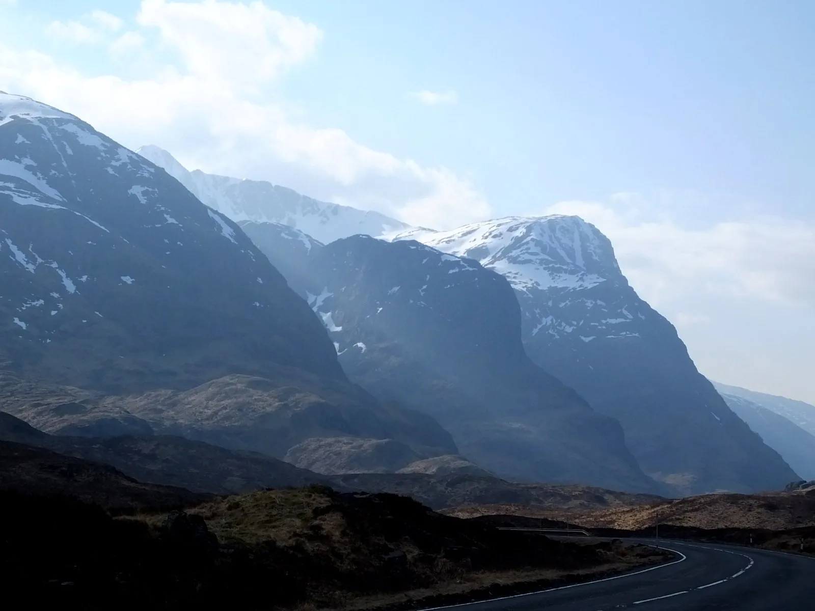
CC BY-SA 2.0. Commons metadata rechecked file by file; files actually served by Odyvero downloaded and decoded: [1600, 1200] pixels, visually inspected. Existing media reused. Nærøyfjord: a Norwegian fjord in April, not Lysefjord or Ringedalsvatnet. Three Sisters: a regional Highlands landscape at Glencoe, not a point on the West Highland Way route.
- Photography: ralph-bergen-naeroy-89435 ↗
Acediscovery / Wikimedia Commons / CC BY 4.0 · Accessed November 1, 2026
What this source supports
CC BY 4.0; reduced and converted to WebP without upscaling; derivative under the same license. Commons metadata rechecked file by file; files actually served by Odyvero downloaded and decoded: [1920, 1440] pixels, visually inspected. Existing media reused. Nærøyfjord: a Norwegian fjord in April, not Lysefjord or Ringedalsvatnet. Three Sisters: a regional Highlands landscape at Glencoe, not a point on the West Highland Way route.
Viator — activity pages
Source for the activity information below.Affiliate links: Odyvero may earn a commission when you book through this article’s buttons.
- Rabaçal and the 25 Fontes with guide and transfer ↗
Accessed November 1, 2026


