 odyvero

Slovenia offers mountain loops that are mostly off-road, as well as much more road-oriented crossings. In the Romanian Carpathians, the Via Transilvanica often calls for a proper mountain bike. Here’s how to choose between these types of terrain, plan your stages, and organize a loaded trip without confusing a gravel route, a cycling tour, and a technical trail.
Three projects, three types of terrain
On the Slovenia West Loop, unpaved roads account for three quarters of the advertised route. Across the Trans Dinarica as a whole, the creators report that about four fifths is paved. In Romania, the Via Transilvanica cycling guide recommends mountain-bike tires. These differences affect fatigue, equipment, and the number of kilometers you can reasonably plan to cover in a day. The bike’s name or a photo of a white gravel road is therefore not enough to choose your trip.
For a first bikepacking trip in this part of Europe, we recommend staying within a single region. In Slovenia, you can choose between a loop that returns to Ljubljana and a crossing starting in the Soča Valley. Romania is better suited to a project focused more on trails and villages, with more extensive technical and logistical preparation. Linking the two countries would add long transfers and substantially change the trip.
The West Loop is for those looking for a sporty week with plenty of unpaved roads and who know how to adapt a route to their bike. The Slovenian Trans Dinarica is a better fit for travelers who want to ride from village to village on a route dominated by small roads. For the Via Transilvanica, we recommend selecting a few consecutive cycling stages rather than aiming for the entire crossing from the outset. Use the cycling-specific guide as your starting point.
The sections below distinguish figures published by the creators from organizational suggestions. Route distances do not predict trail conditions when you ride. A trail may be damaged, access may be restricted, or a climb may still be snow-covered: checking the latest local information is part of the preparation.
The Slovenian West Loop
The Slovenia West Loop is a loop documented by BIKEPACKING.com, starting in Ljubljana. The route page, updated in May 2026, lists 426 kilometers and 8,878 meters of elevation gain, over six to eight days. It states that 75% of the surfaces are unpaved and 5% are narrow trails, or singletrack. This profile makes it important to look at the days one by one: repeated climbs matter more than a distance that might seem modest on the road.
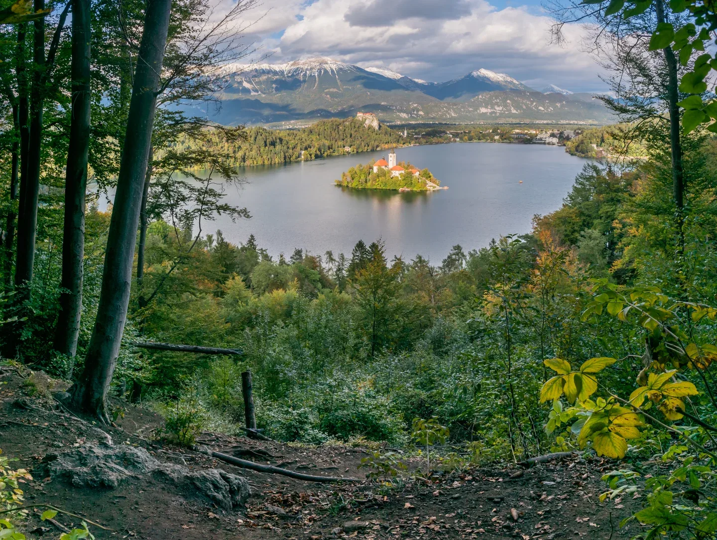
The route’s appeal lies in its variety. It takes in Lake Bled, scenery in Triglav National Park, Vršič Pass, the Soča Valley, and the Kolovrat border area. Unpaved sections alternate with villages and mountain roads. The description also includes a short detour into Italy. Prepare your documents and maps for the entire route, even though the trip is mainly in Slovenia.
The route was designed for a hardtail mountain bike. A suitably equipped gravel bike may work for much of the route, but the technical notes suggest bypassing some singletrack sections and recommend knobby tires wider than 40 millimeters. Points of interest on the GPX track flag difficult sections. Read them before setting off: a simple colored line on the screen does not show this information.
The gearing deserves as much attention as the tires. The contributor recommends a lowest gear ratio of at least 1:1 for the steep climbs. With luggage, an even lower gear may be useful, depending on your riding style. Test your easiest gear on a real climb with fully loaded bags before deciding that your usual bike will be enough. You may need to walk some sections, and that time should be factored into your day.
In the Kobarid area, an alternative via Tolmin avoids the Kolovrat and rejoins the main route farther on. It may suit travelers who prefer a more accessible ride or are adapting their plans to conditions. Compare both options on the map, including their endpoints and accommodation. Choosing an alternative before setting off gives you more flexibility than discovering it late in the mountains.
For this trip, allow for the advertised six to eight riding days, then add the days needed for arrival and return. An extra night in Ljubljana or a spare day makes the trip much more flexible. If your vacation week already includes international travel, choose part of the route and plan an exit rather than trying to squeeze in the entire loop.

The Slovenian Trans Dinarica
The Trans Dinarica connects several Balkan countries through a documented cycling network. Its route is predominantly paved: the designer’s FAQ states that about 80% of the entire network consists of paved roads. For the Slovenian route, the published share is 79% asphalt and 21% unpaved. It is therefore well suited to a versatile bike tour, with stops in small towns and a proportion of trails that varies by stage.
The main Slovenian starting point is Tolmin. The crossing follows the Soča toward Nova Gorica, then continues through the Karst toward Sežana and Ilirska Bistrica. It combines river scenery, vineyards, limestone plateaus and villages. The detailed stages provide a more useful picture than the network’s overall length alone, particularly when planning overnight stays and visits.
Tolmin–Nova Gorica is listed as 42 kilometers with 590 meters of elevation gain. Nova Gorica–Sežana is 53 kilometers with 800 meters; Sežana–Ilirska Bistrica is 54 kilometers with 890 meters. These figures come from the designer’s stage descriptions and refer to the named sections. The page also includes variants: always check that the track you download matches the stages you have selected, and do not mix different versions when calculating your trip.
The stage between Sežana and Ilirska Bistrica passes through Lipica and the area around the Škocjan Caves. If you plan a visit, check the opening hours, bike parking options and how much time you will actually have before booking your overnight stay. A day that includes a long underground tour requires different planning from a day devoted entirely to riding. It may be better to shorten the stage or stay two nights in one area.
Continuing from Ilirska Bistrica toward Čavle takes you into Croatia. The designer lists this stage as 50 kilometers with 810 meters of elevation gain. If you want to stay in Slovenia, plan your exit before that point. If you continue, arrange your return from the other country and check which transport services actually accept your bike. A point-to-point crossing calls for this decision at the very start of your planning.
The Trans Dinarica is signposted digitally. Its navigation packs are therefore an important resource: the Basic pack includes GPX tracks and points of interest, while the Full pack adds, among other things, more detailed stage and surface information. The free overview maps and PDF stage sheets are useful for an initial look. Then choose the tool that suits your level of independence and test that it works offline.
The Via Transilvanica by mountain bike
The Via Transilvanica crosses Romania, linking rural landscapes, small towns and historic regions. The Tășuleasa Social association publishes a dedicated guide for cyclists, separate from the one for walkers. Use this cycling version to plan a bike tour: the difficulties, variants and ways of dividing the stages differ from those of a hike.
The cycling guide, updated in May 2026, recommends a mountain bike with tires at least 2.1 inches wide. It describes particularly demanding sections in Bucovina and substantial hike-a-bike stretches in some areas. For a trip with panniers, we therefore recommend using a mountain bike you already know how to handle on rough terrain. A lightweight bike cannot make up for a lack of traction, braking power or confidence on descents.
For a first look, the Terra Saxonum stages are worth exploring in the guide: Cloașterf–Sighișoara, Sighișoara–Mălâncrav and Mălâncrav–Richiș are listed separately. The inclusion of Sighișoara makes it possible to combine the trip with a city and heritage stop. Your final choice will then depend on the elevation profiles, access and available accommodation. These place names do not describe an easy, ready-to-ride gravel loop that requires no adaptation.
It is also important to distinguish the full network from the documented cycling routes. The website now describes the Via Transilvanica as 1,600 kilometers long; the cycling guide still refers in its introduction to about 1,400 kilometers. For your trip, use the distances for the cycling stages you actually choose and the corresponding track. The network’s overall figure does not give the exact length of a bike tour.
Rain is an important factor in deciding when to ride here. The guide flags muddy areas that can slow progress considerably and recommends waiting for the ground to dry. Keep a spare night in your schedule and be prepared to move a stage. A rigid booking at a distant destination can pressure you to continue in conditions that diminish enjoyment, strain your equipment and damage the trails.
Accommodation also needs to be arranged by phone, especially in small villages. Confirm that you will be welcomed on your date, that dinner is available and that there is a suitable place for your bike. The guide provides contacts, but an establishment listed in an edition is not necessarily available now. For a first trip, a few well-organized days along consecutive stages leave more time to explore than an ambitious crossing paced around transport connections.
The season and daily stages
For the West Loop, the route page generally recommends the period from late May to early September, with a risk of snow at higher elevations outside that window. For the Trans Dinarica as a whole, the published general guidance is May to September. Use these recommendations to choose when to start looking; the forecast and the condition of the passes determine when to set off.
In Romania, the Via Transilvanica cycling guide gives May to October as the season and advises against winter riding. In October, however, you need to consider daylight hours, the weather and which accommodations are open. In late autumn, it is better to plan for the following season than to count on an improvised mountain crossing. The fact that accommodation is open in a town says nothing about services at a remote rural stop.
To plan your daily stages, note the distance, elevation gain, surface and destination. Allow time for meals, photos, visits and any hike-a-bike sections. For the Trans Dinarica, the designer emphasizes being able to climb around 1,000 meters in a day, sometimes more depending on the section. Your usual average speed on roads says little about this kind of effort with a loaded bike.
We recommend making the first day deliberately short, with confirmed accommodation and an identifiable fallback option. This gives you time to adjust your panniers, check your brakes and get a feel for the group’s pace. For subsequent days, plan to arrive before late afternoon rather than spending every hour of daylight covering the scheduled distance. This buffer is useful for both unexpected delays and discoveries along the way.
The bike and panniers
For the West Loop, choose a hardtail or a gravel bike capable of handling rough trails based on the sections included in the track. For the Slovenian Trans Dinarica, a versatile touring bike suits the described mix of roads and trails. On the Via Transilvanica, follow the official mountain bike recommendation when preparing. The same setup is therefore not meant to work equally well for all three trips.
A test ride with all your luggage will reveal things that spec sheets cannot. Your panniers should remain stable when you brake, stand on the pedals or push the bike. Check for clearance around the tires and cables. Keep anything you need during the day within easy reach, and pack night-time clothing and documents separately to protect them from moisture.
Your repair kit should suit your bike and your skills. Bring what you need to fix a puncture, reinflate a tire, work on the chain and deal with minor parts coming loose. Before setting off, check the condition of your tires, brake pads and drivetrain. Pay particular attention to any hard-to-replace specialized parts; repair shops are not available at every rural stop.
If you are riding an electric bike, confirm that you can recharge it at every overnight stop and test its range with your planned load. Elevation gain, terrain and assist level can all have a major effect on power consumption. Also account for the difficulty of pushing a heavy bike on technical sections in Romania. Choosing suitable accommodation and planning a suitable stage go hand in hand.
Tracks and access
Download up-to-date tracks from the creators’ resources and keep a note of their date. Import points of interest when your device allows it: they may indicate a variation, a technical section, or a service. A second copy accessible on your phone, together with an offline basemap, is a useful backup if your cycling computer fails. Test the setup by turning off mobile data.
Triglav National Park regulates cycling according to its zones and permitted routes. Its management authority publishes the rules and a map of acceptable routes. Consult them in addition to the West Loop GPX. A trail appearing in an app or used by a contributor does not automatically mean cycling is permitted there. On site, follow signs and closures, and look for an authorized alternative.
The park authority and the Romanian cycling guide also recommend riding during the day. Bring lights so you can be seen and handle delays, while planning your stages to finish before dark. In areas frequented by walkers, slow down as you approach people and leave plenty of room. Near livestock, keep your distance and ask the shepherd for help if dogs block the way.
For connectivity, check your plan first: occasional stays in the European Union generally fall under roaming at domestic rates, subject to fair-use conditions and a data allowance you should check. An offline map remains essential in areas without coverage. Also save accommodation contact details and return-trip information somewhere other than an email accessible only online.
Overnight stays and budget
In Slovenia, choose authorized campsites and accommodation. In Triglav National Park, overnight stays and camping outside designated sites are prohibited. This rule makes it possible to plan stages clearly without relying on assumed tolerance after dark. Book according to the season, visitor numbers, and group size; ask how to store bicycles and dry gear.
In Romania, the family-run guesthouses and small pensions mentioned in the guide can serve as overnight stops. A call in advance lets you confirm the number of places and whether meals are available. Also plan to carry cash for rural expenses: card payment should not be your only option. Check shopping opportunities before leaving a town, especially on a Sunday or public holiday.
Build your budget around five categories: transport to the start, overnight stays, food, route information or navigation, and a reserve for repairs and itinerary changes. Add any fees for transporting your bicycle and, for a one-way trip, the return journey from the finish. The price of a bed, a campsite pitch, and a room with dinner is only meaningfully comparable when the services included are the same.
Plan water and shopping one day at a time. Look for services in the route materials and confirm locally which water points are safe to drink from. Clear-looking river water is not a verified source. Keep enough food in reserve to reach the next stage if a shop is closed. If you have meals with your hosts, mention your dietary needs when booking rather than on arrival.
Getting there and getting back
The West Loop has the logistical advantage of returning to Ljubljana. You can arrange your first and last nights there, as well as storage for a transport box, if your accommodation agrees. Check your carrier’s bicycle requirements: space reservation, disassembly, cover, dimensions, and connections. A passenger ticket alone does not confirm that an unassembled bicycle can be transported.
For the Trans Dinarica, the route designer identifies Most na Soči station as a useful access point for starting in the Tolmin area. They also mention the Nova Gorica–Sežana railway connection as a backup option. Check with the carrier for your date and train, including bicycle space: these logistical suggestions are not a reservation. Plan the final leg between the station and your first night’s accommodation.
In Romania, first choose the cycling area, then your entry and exit points. Find connections to your chosen village and check that bicycles are accepted on each segment. For a short crossing, a transfer arranged in advance may make more sense than a long day of cycling back. If so, explicitly confirm the number of bicycles, how they will be loaded, and the type of vehicle planned.
A day in Ljubljana before the loop
A day in the capital can come before departure or extend your return from the West Loop. It gives you time to assemble your bicycle, buy anything you forgot, and enjoy the city without panniers. For a guided introduction, the Ljubljana bicycle tour offered by the operator via Viator passes through the city center, Metelkova, Tivoli, and the banks of the Ljubljanica. The guide provides commentary in English.
The experience includes a bicycle, helmet, and snacks, with a stated meeting point at the Prešeren Monument and a return to the same place. We recommend it for those who want to spend half a day exploring the city on a provided bicycle. Guiding for mountain routes, long-term rental, and baggage transport must be arranged separately. The card displays commercial details about the activity.

Viator
Cycling in Ljubljana with a local guide
Explore Ljubljana without panniers before or after the West Loop, with a provided bicycle and an English-speaking guide.
- 3 h 30
- 4.8/5 (168 reviews)
An English-language city tour with a bicycle, helmet, and snacks, to discover Ljubljana before or after a hike.
Cancellation policy
For a full refund, cancel at least 24 hours before the scheduled departure date.
From €35.00
View activityFAQ
Which route should you choose for your first bikepacking trip in Slovenia?
The Slovenian section of the Trans Dinarica is the first route to consider if you are looking for a mostly road-based mix and stages between villages. The West Loop suits cyclists who are already comfortable on loaded trails and prepared to adapt some sections. For both routes, check the daily elevation gain and plan a short first stage. A test trip close to home can help you choose the right level of ambition.
Is a gravel bike enough for the West Loop?
A suitable gravel bike can handle much of the loop, with sufficiently wide tires, low gearing, and careful selection of variations. The route information notes that it was originally designed for a hardtail mountain bike and flags singletrack sections that need consideration. With a more road-oriented gravel bike, modify the route rather than assuming all sections are equivalent.
Does the Trans Dinarica mostly follow trails?
The route designer states that about 80% of the full network is paved, and 79% for its Slovenian overview. The proportion of unpaved routes varies considerably from stage to stage. Check the surfaces on your chosen section to select your tires and plan your days. The word gravel may describe the type of bike used without implying that unpaved routes make up most of the trip.
How long should you allow for the Slovenia West Loop?
The route information gives six to eight days for its 426 kilometers. Allow extra time for transport, assembling your bicycle, and a buffer appropriate to your trip. If you only have a week door to door, plan a partial version with a realistic ride and sensible overnight stops. Cutting out sightseeing may not be enough to make up for the days spent traveling.
Can you ride the Via Transilvanica on a gravel bike?
The cycling guide recommends a mountain bike and tires at least 2.1 inches wide, with technical sections and hike-a-bike. For a full trip or a first loaded ride, that recommendation is the safest starting point. A route adapted for a gravel bike requires a detailed review of the stages and alternatives. The hiking route should not be used as a shortcut for planning.
Can you camp freely in Triglav?
The park prohibits overnight stays and camping outside designated sites. Choose an authorized campsite or accommodation and plan your days around those stops. Other travelers’ accounts and informal bivouac suggestions do not replace the park authority’s regulations. Plan to arrive early enough to reach your reserved site.
Do you need to buy an eSIM for these routes?
First check what data your plan covers in the European Union, its conditions, and the countries included. For a trip from France to Slovenia or Romania, an additional plan may be unnecessary. Download maps and tracks before departure: an eSIM does not guarantee coverage in every valley and does not replace independent offline navigation.
Where can you find reliable tracks and information?
The BIKEPACKING.com route page brings together West Loop resources; the Trans Dinarica website offers its maps and navigation packs; and Via Transilvanica publishes a cycling guide and an app. Supplement these materials with Triglav regulations, carrier information, and accommodation confirmations. Keep the resources that match the exact version of your route.
Sources and checks
Plan your visits and check current conditions.
- Slovenia West Loop
BIKEPACKING.com / Joe Cruz · Accessed November 1, 2026
What this source supports
426 km, 8,878 m of elevation gain, six to eight days, 75% unpaved; May 2026 version. Bike, alternatives, and seasonal window.
- Trans Dinarica preparation and navigation
GoodPlace / Trans Dinarica · Accessed November 1, 2026
What this source supports
About 80% paved; digital navigation; packs, season, services, and elevation.
- Trans Dinarica stages in Slovenia
GoodPlace / Trans Dinarica · Accessed November 1, 2026
What this source supports
Surfaces and stages: Tolmin–Nova Gorica–Sežana–Ilirska Bistrica, then Čavle; sights and logistics leads, to be confirmed with the carrier.
- Via Transilvanica: the network and resources
Tășuleasa Social · Accessed November 1, 2026
What this source supports
The network is described as 1,600 km long; a separate cycling guide and offline app are available.
- Official cycling guide, updated May 2026
Tășuleasa Social · Accessed November 1, 2026
What this source supports
Page providing access to the Cyclist’s Guide. The introduction and PDF contents page were reviewed: mountain bikes and tires at least 2.1 inches wide, Bucovina’s difficulties, May–October, rain, accommodation; Terra Saxonum. The guide’s introduction still gives a distance of about 1,400 km.
- Cycling in the Triglav
Triglav National Park · Accessed November 1, 2026
What this source supports
Zoning, permitted routes, restrictions, and daytime use.
- Triglav National Park visitor rules
Triglav National Park · Accessed November 1, 2026
What this source supports
Camping and overnight stays are permitted only in designated areas.
- Mobile roaming in the European Union
European Union / Your Europe · Accessed November 1, 2026
What this source supports
Roaming at domestic rates for occasional travel, subject to your plan and fair-use policy.
- Ljubljana bike tour
Viator / operator · Accessed November 1, 2026
What this source supports
ACTIVE product verified through Partner API Basic; English-speaking guide, 210 minutes, bike, helmet, and snacks; meeting point and return at the Prešeren statue. Odyvero affiliate link.
Viator — activity pages
Information about the offers featured in this article.Affiliate links: Odyvero may earn a commission when you book through this article’s buttons.
- Viator : Cycling in Ljubljana with a local guide
Accessed November 2, 2026


